


Meteorologist Kyle Grainger says a few afternoon and evening thunderstorms could become strong to severe, bringing damaging wind gusts and locally heavy rainfall before additional storms return Monday.
Sunday
- Morning: Partly sunny and generally quiet.
- Afternoon (after 2 PM): Showers and thunderstorms become likely (60% chance).
- High: Around 86°F .
- Main hazards:
- A few storms could become strong to severe.
- Strong, gusty winds are the primary concern.
- Locally heavy rainfall could cause brief ponding on roads and reduced visibility.
- Rainfall: Generally 0.10–0.25 inches, but thunderstorms could produce higher amounts.
Sunday Night
- A 30% chance of showers and thunderstorms, mainly before 1 AM.
- Becoming partly cloudy overnight.
- Low: Around 68°F .
Monday
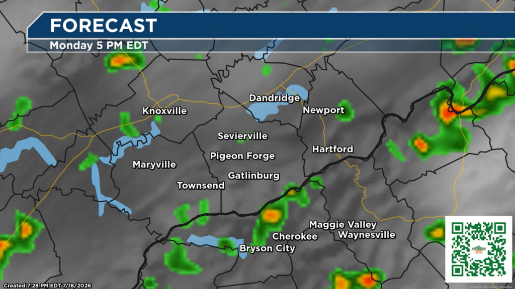
- A chance of showers in the morning.
- Scattered showers and thunderstorms around midday.
- Showers and thunderstorms become more likely after 2 PM (70% chance).
- Mostly sunny between storms.
- High: Around 86°F.
What this means
- If you have outdoor plans on Sunday afternoon or Monday afternoon, keep an eye on the sky and have a way to receive weather alerts.
- The greatest concern is strong wind gusts, though heavy downpours may briefly reduce visibility and create localized flooding in low-lying areas.
- Storms will likely be scattered, meaning not everyone will experience severe weather, but any storm that becomes severe could produce damaging winds.
5 Responses
I like the bullet points, but would like to see more weather information for Morgan County. All we ever see is weather for Knoxville and the Smokies.
I like the bullet points better.
Really like bullet points best!
I like the bullet points. It’s more to the point and more understanding.
don’t make me choose! I like both.