

Strong to severe storms possible Wednesday afternoon before cooler weather arrives
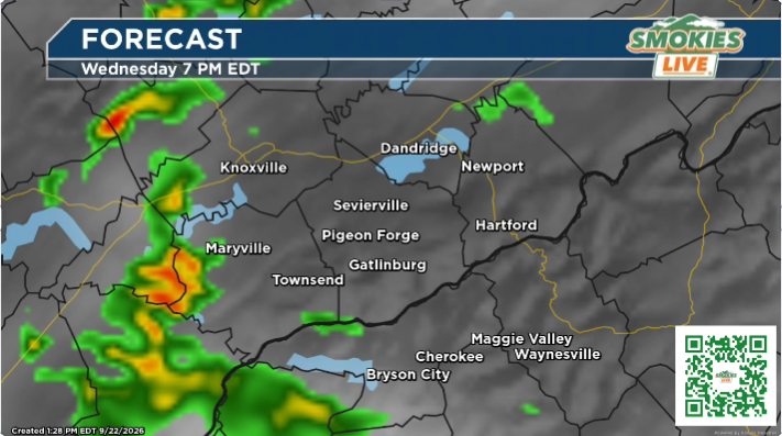
EAST TENNESSEE (Smokies.LIVE Storm Center) — Storm chances return Wednesday as a pattern shift brings rounds of showers and thunderstorms across East Tennessee and the Smokies.
Spotty showers and storms could develop early Wednesday, but storms are expected to become more widespread during the afternoon.
Some storms could become strong to severe, with the potential for:
- 🌧️ Heavy rain and localized flooding
- 💨 Strong, gusty winds
- 🧊 Small hail
- 🚗 Ponding of water on roads
The greatest concern will be where repeated rounds of storms move over the same areas. Drivers should be alert for water-covered roads and reduced visibility.
🌡️ Cooler weather follows
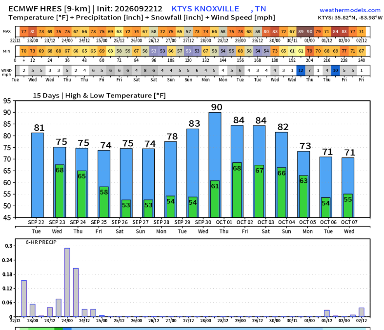
Wednesday will mark a transition to a cooler weather pattern. Tuesday will be the last day with above-normal temperatures, with temperatures near normal Wednesday.
By Thursday, below-normal temperatures are expected, with the cooler pattern continuing through the weekend.
Most Valley locations will see temperatures primarily in the 70s through the weekend before warmer weather returns next week, with many areas climbing back into the 80s. One example of the short cool period. Courtesy Weathermodels.com
🌩️ STORM CENTER TIMELINE
Early Wednesday: Spotty showers and storms possible.
Wednesday afternoon: Storm coverage increases. Strong to severe storms are possible.
Wednesday night: Storm chances gradually decrease, with cooler air moving in.
Storm Center Tip: Don’t let the cooler weather forecast Thursday and beyond catch you off guard — Wednesday is the day to stay weather aware. Keep Smokies.LIVE Radar handy and check conditions before traveling.
Where it rains, it pours.

No responses yet