

🌧️ Smokies.LIVE Storm Center: Sunday looking increasingly wet
Rain coverage increases this weekend, with 1–3 inches possible and locally higher amounts
GATLINBURG, Tenn. (Smokies.LIVE Storm Center) — The wet weekend forecast is coming into better focus, with Sunday now looking like the wetter day across much of the Smokies and East Tennessee.
SATURDAY
Rain will linger across northern counties Saturday morning before spotty showers and thunderstorms become more numerous during the afternoon.
As a frontal boundary sinks south, some storms could produce heavy downpours, creating localized flooding concerns.
Highs will be in the low 80s.
GAME DAY SATURDAY: Heading to Neyland Stadium to watch Tennessee take on Auburn? Take the poncho. A downpour could develop at any point during the game, although rain is not guaranteed for everyone.
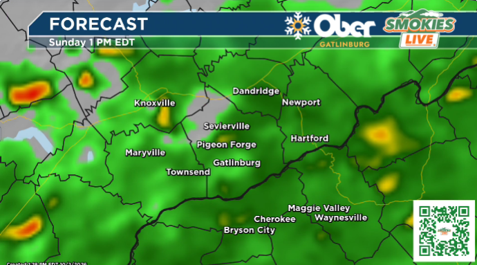

🌧️ SUNDAY
Sunday is becoming the main weather day to watch.
Rain coverage is expected to increase to near 100% across the region, especially around Knoxville and areas along and south of I-40 into the foothills and Smokies.
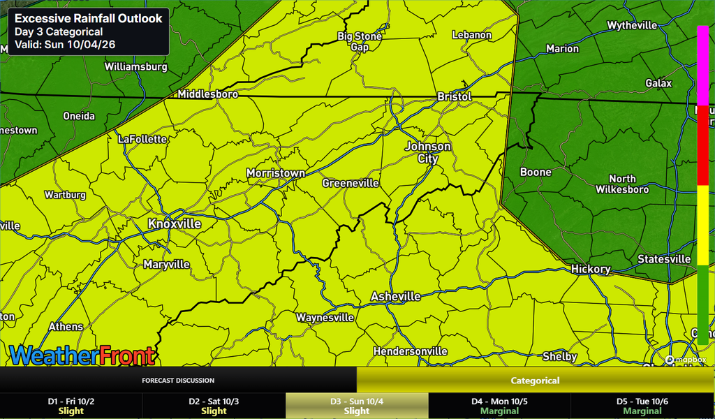
Periods of heavy rain will be possible, and 1–3 inches of rain remains on the table, with some locations potentially seeing higher totals.
Rain should gradually taper from north to south through the afternoon, with highs only reaching the mid to upper 70s.
☀️ NEXT WEEK
The pattern improves quickly. Sunshine returns with seasonal temperatures, featuring highs in the mid to upper 70s and lows in the low 50s.
Where it rains, it pours. Keep Smokies.LIVE Radar handy.

No responses yet