

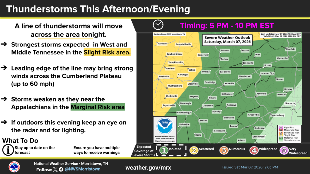
(SEVIERVILLE, Tenn.) SMOKIES.LIVE – The level one risk for severe storms this evening is still there. A line of storms is moving across Tennessee and into the Smoky Mountain region.
This front will produce scattered to numerous thunderstorms over the next few hours.
I would plan on the storms arriving in Knoxville after 7 p.m. and the Smokies between 8 & 9 p.m.
The Storm Prediction Center has placed the Smoky Mountains in a level 1 risk for severe storms. We should be prepared for gusty winds as the primary threat. Downpours and thunder with lightning will push these storms into dangerous categories.
Winds will gust on Saturday between 20-25 mph in these storms. The storms become more widespread into the afternoon on Saturday after 2 p.m. Some of the downpours could lead to runoff issues in some areas. Visitors in Great Smoky Mountains and surrounding communities should plan for quickly rising creeks and streams. Be prepared to move to higher ground in a minutes notice.
You should keep weather alerts turned on for the afternoon on through Sunday.
Smokies.LIVE Weather will have updates 24/7 and streaming on the Smokies.LIVE Streaming Network.

No responses yet