


(CHEROKEE, N.C.) SMOKIES.LIVE – The National Weather Service has issued an Ice Storm Warning for the Great Smoky Mountains of Western North Carolina.
Expect trees and power lines to come down during the winter storm hitting western North Carolina. The ice and snow mixed with winds at 30 mph will make for a dangerous situation.
Travel should be avoided and alternative power sources should be considered a this time.
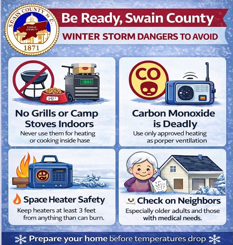
Swain County Emergency Management posted on Facebook, “Be Ready, Swain County – Winter Storm Prep Starts Now” on Friday morning.
NATIONAL WEATHER SERVICE ADVISORY
ICE STORM WARNING REMAINS IN EFFECT FROM 1 PM SATURDAY TO 1 PM
EST MONDAY...

* WHAT...Significant icing, with additional impacts from
  accumulating sleet expected.  Total snow and sleet accumulations
  up to two inches and ice accumulations between one half and one
  inch. Winds gusting as high as 30 mph.

* WHERE...A portion of northeast Georgia.

* WHEN...From 1 PM Saturday to 1 PM EST Monday.

* IMPACTS...Ice and snow covered roadways will become treacherous
  and impassable. Widespread power outages are likely due to the
  weight of the ice and snow on tree limbs and power lines. The
  outages could last for days in some areas. The hazardous
  conditions could impact the Monday morning commute.
No responses yet