

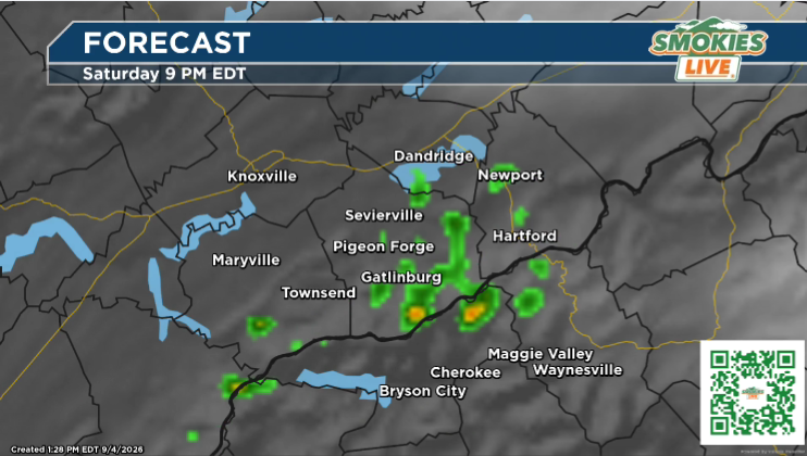
Storm window expected from 3 p.m. Saturday through 1 a.m. Sunday.
KNOXVILLE, Tenn. (Smokies.LIVE Storm Center) — After another round of dangerous heat Saturday, thunderstorms could bring a significant change in weather across parts of East Tennessee and Western North Carolina.
A Level 2 of 5 risk for severe weather includes portions of the region, including Knoxville, Sevierville, Dandridge, Newport and Waynesville, North Carolina.
⛈️ Storm timing
The greatest potential for strong to severe storms is expected from about 3 p.m. Saturday through 1 a.m. Sunday.
The main threats will be:
- Damaging wind gusts of 60 mph or greater
- Large hail
- Locally strong thunderstorms
Not everyone will see severe weather, but storms that do become severe could produce dangerous wind gusts and hail.
🌡️ Heat first, storms later
The storm threat comes after another hot and humid afternoon, making Saturday a day to keep weather alerts handy from start to finish.
If you have outdoor plans, know where you can go quickly if a thunderstorm approaches.
When thunder roars, go indoors.
Smokies.LIVE Storm Center — tracking the heat, then watching the storms roll in.

No responses yet