

Wind gusts up to 50 mph possible as storm moves south.
KNOXVILLE, Tenn. (Smokies.LIVE Storm Center) — A Special Weather Statement is in effect as a strong thunderstorm moves across the Knoxville area this afternoon.
At 12:58 p.m. EDT, National Weather Service Doppler radar was tracking a strong thunderstorm near Knoxville, moving south at 25 mph.
🌩️ WHAT TO EXPECT
Hazard: Wind gusts up to 50 mph
The storm is radar-indicated, and strong gusty winds could knock down tree limbs and blow around unsecured outdoor objects.
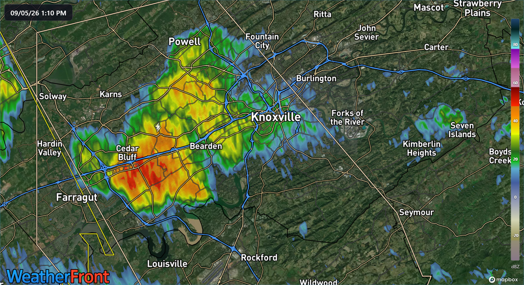
📍 LOCATIONS IMPACTED
The storm could affect:
- Knoxville
- Oak Ridge
- Maryville
- Alcoa
- Farragut
- Louisville
- Rockford
- Eagleton Village
- Friendsville
- Karns
If you’re in the path of the storm, secure loose outdoor items and be prepared for a sudden burst of strong winds.
This is not a Severe Thunderstorm Warning, but conditions can still become hazardous quickly.
Smokies.LIVE Storm Center is watching the skies.
When thunder roars, go indoors.

No responses yet