

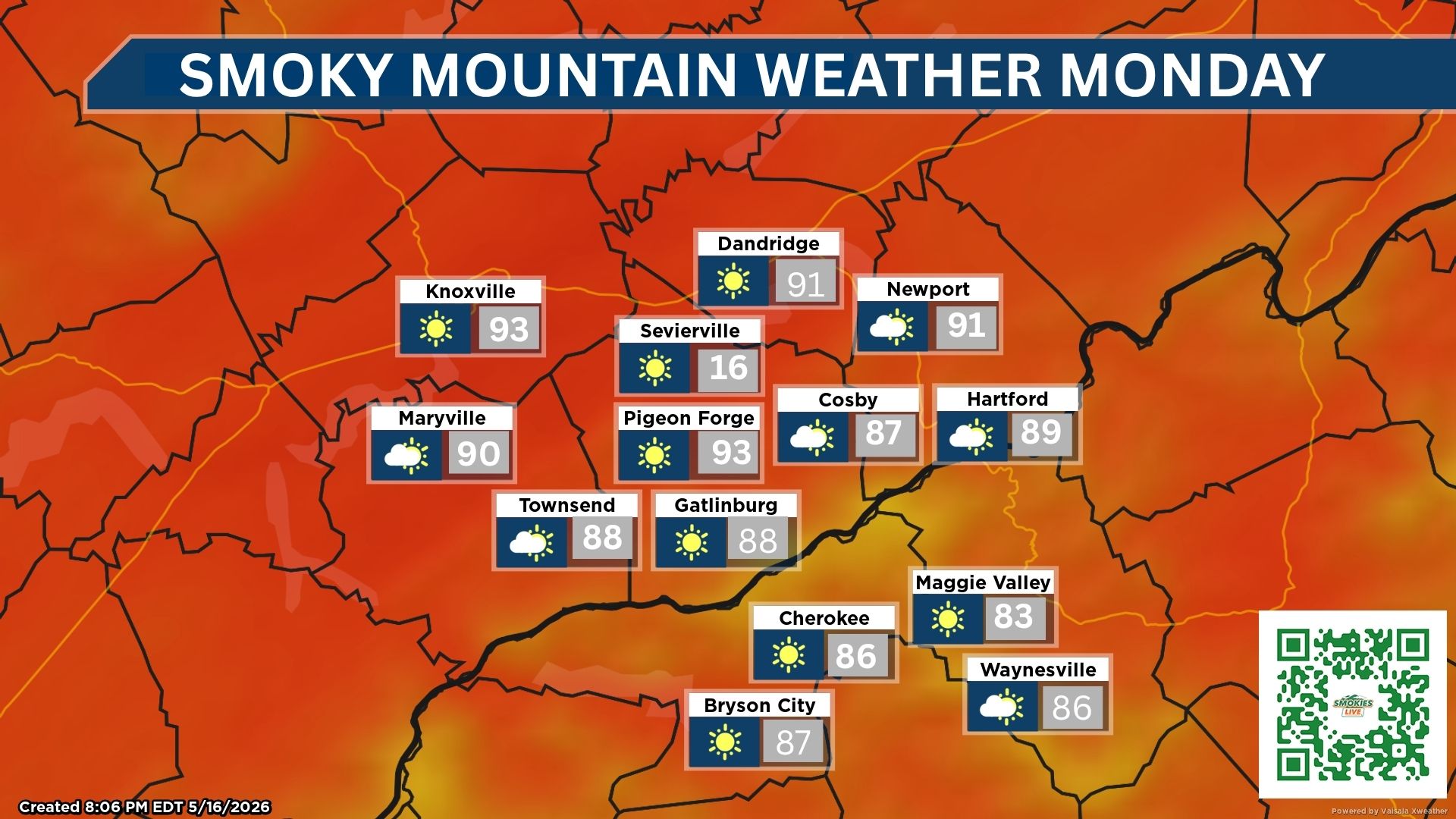
Highs reach the lower 90s across the Smokies, with daily afternoon storm chances
GATLINBURG, Tenn. (Smokies.LIVE Storm Center) — The heat continues across the Smokies Sunday and Monday, with temperatures climbing into the lower 90s and scattered showers and thunderstorms possible each afternoon.
🌤️ SUNDAY
Pigeon Forge
- Mostly sunny and hot
- High: 92°
- 50% chance of showers and thunderstorms, mainly after 11 a.m.
- Light winds becoming west around 5 mph
- Sunday night: Partly cloudy, low 67°
- 30% chance of storms, mainly before 8 p.m.
Bryson City
- Mostly sunny and hot
- High: 92°
- 20% chance of showers and thunderstorms after 2 p.m.
- Light southwest winds around 5 mph
- Sunday night: Partly cloudy, low 70°
- 30% chance of showers and thunderstorms before midnight
☀️ MONDAY
Pigeon Forge
- Mostly sunny and hot
- High: 92°
- 50% chance of showers and thunderstorms after 11 a.m.
- Light winds
Bryson City
- Mostly sunny and hot
- High: 92°
- 40% chance of showers and thunderstorms after 2 p.m.
- Calm winds
- Monday night: Mostly cloudy, low 68°
- 50% chance of showers and thunderstorms
🥾 HIKING & MOUNTAIN TRAVEL
If you’re heading into the mountains Sunday or Monday, keep Smokies.LIVE Radar handy. Most of the day should be dry, but afternoon heating could spark showers and thunderstorms.
The best chance for storms will generally be during the afternoon and early evening, so hikers should keep an eye on the sky and have a plan to get off exposed ridges if thunderstorms develop.
Where it rains, it pours — but not everyone will see rain.
No responses yet