

(SEVIERVILLE, Tenn.) SMOKIES.LIVE – A widespread dangerous weather event is developing for the eastern half of the United States, including the Smoky Mountain region.
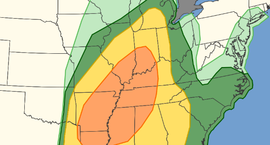
Numerous severe storms could have a huge impact on the East Tennessee area. The primary threat will be strong winds 60+ mph from 1 a.m. to 5 a.m. Monday morning. The Storm Prediction Center has the area on a level 1 and 2 risk for severe storms.
The National Weather Service has already issued a High Wind Warning for the Smoky Mountains. These winds will bring down some trees.
NWS MORRISTOWN
HIGH WIND WARNING IN EFFECT FROM 2 AM SUNDAY TO 10 AM EDT
MONDAY...

* WHAT...South winds 25 to 40 mph with gusts up to 65 mph possible.

* WHERE...Blount Smoky Mountains, Cocke Smoky Mountains, Johnson,
  Sevier Smoky Mountains, Southeast Carter, Southeast Greene,
  Southeast Monroe, and Unicoi Counties.

* WHEN...From 2 AM Sunday to 10 AM EDT Monday.
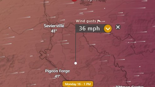
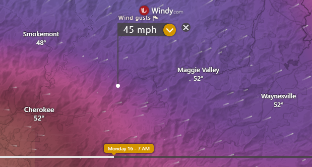
Damaging winds could ramp up to 75+ mph when the main line of storms approaches the area early Monday morning.
Hikers in the Great Smoky Mountains need to watch for falling trees and tree limbs. Motorists should plan for road closures in the Smokies due to the wind threats.
Plan for at least a half inch of rain which could strain area creeks, streams and rivers. Anyone camping near a river should be prepared to move to higher ground.
Monday afternoon remaining rainfall will transition to snow through early Tuesday morning. New snow accumulation of less than a half inch possible in the lower elevations for both North Carolina and Tennessee mountain communities.
Newfound Gap could see new snow accumulation of 1 to 2 inches possible. The snow will start in the Higher elevations before 12-noon on Monday and continue through early Tuesday.
THE LATEST RADAR AND FUTURE RADAR AT SMOKIES LIVE WEATHER PAGE
12 Responses
Good reporting Kyle and updates.
Thanks.
Thank you!
Hey Kyle we are coming to pigeon forge for the week how will the weather be we are arriving this afternoon
It all depends on when you arrive. Storms will be overnight 1 a.m. to 5 a.m. Monday morning.
Good reporting with updates.
Thanks Kyle.
Thank you!
Thank you for keeping us aware! I appreciate hoe succinct your reports are!
You are welcome. I hope this helps you plan.
My favorite meteorologist working hard! Thanks for all you do for our community!
Thank you! I hope this information helps you prepare for the night ahead.
Thank you for keeping us updated.
Thank you I hope this helps you stay alert.