

Thursday will bring some strong to severe storms moving across the Smoky Mountain region with remnants of Arthur moving into the North Carolina Mountains on Friday.
(SEVIERVILLE, Tenn.) SMOKIES.LIVE – All day long on Thursday we’ll be updating the latest on a severe weather threat for Thursday and a flooding risk for the mountains on Friday.
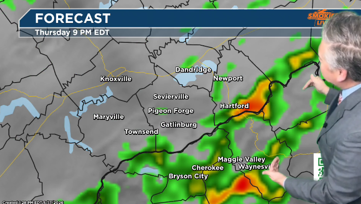
Let’s start with Thursday and the threat for strong storms. The primary threat here will be strong storms with gusty winds. Winds up to 60+ mph can’t be ruled out on Thursday. The primary damaging storms will move in between 5 p.m. and 8 p.m. with areas between Pigeon Forge and Gatlinburg closer to 5 p.m. and areas of Maggie Valley and Waynesville between 7 p.m. and 8 p.m.
Will storms be bad on Thursday?
A severe storm is possible with these storms approaching the mountains of Western North Carolina. Have a way to get alerts.
Will there be flooding on Friday in the Mountains?
Friday, the North Carolina Smoky Mountains will get a few waves of rain from the remnants of Tropical Storm Arthur. The potential for a few tropical downpours will be possible. It looks like a good quarter to half inch of rain between Cherokee and Waynesville. There is a small threat to creeks and streams. Keep a way to get NWS alerts handy.
As always, Smokies.LIVE Weather will have the latest on where storms are, and you can use the Future Tracker to track ahead where you live and work.
No responses yet