


🚨 SMOKIES.LIVE STORM CENTER ALERT
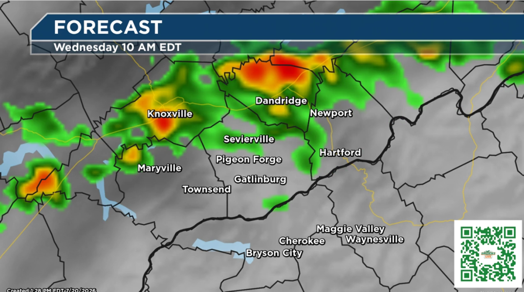
The Smokies.LIVE Storm Center is closely monitoring the potential for strong to severe thunderstorms across East Tennessee and the Smoky Mountains Tuesday night into Wednesday morning.
The primary threats at this time include:
- 🌧️ Localized flooding from heavy downpours
- 💨 Damaging wind gusts capable of downing trees and power lines
There is also a very low risk of an isolated tornado. That threat will depend on whether a stable layer of air develops near the ground overnight. While the tornado risk remains low, it cannot be completely ruled out.
Now is a good time to:
- Make sure you have a way to receive weather warnings overnight.
- Charge your electronic devices.
- Stay weather-aware if you have travel or outdoor plans late Tuesday.
The forecast may change as new data becomes available. The Smokies.LIVE Storm Center will continue to monitor conditions and provide updates as confidence increases.
Stay with Smokies.LIVE and Meteorologist Kyle Grainger for the latest forecast updates and any watches or warnings that may be issued. You can also sign up for Kyle’s personal daily weather update and alerts when severe weather threatens for free. No Apps, No Updates, just direct communication from Kyle.
No responses yet