

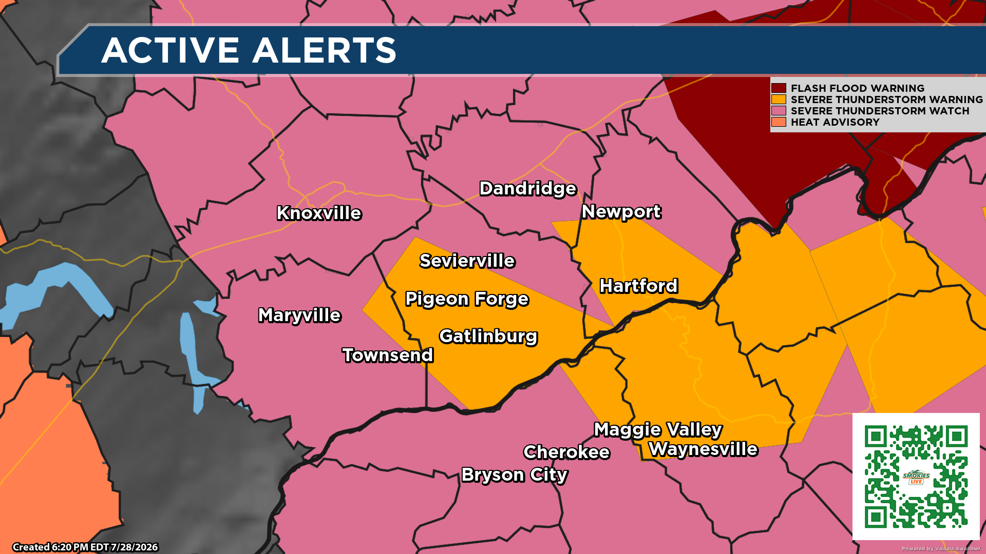
Severe Thunderstorm Warning Issued for Sevier County and Portions of Blount & Cocke Counties Until 7:00 PM
From the Smokies.LIVE Storm Center
Meteorologist Kyle Grainger
WATCH LIVE FROM THE SMOKIES LIVE STORM CENTER LIVE STREAM

⚠️ Take action now if you’re in Sevier County or nearby areas. A Severe Thunderstorm Warning is in effect until 7:00 p.m. EDT for Sevier County, northeastern Blount County and southwestern Cocke County.
📍 At 6:09 p.m.
A severe thunderstorm was located near Pigeon Forge, about 7 miles northwest of Gatlinburg, moving southeast at 35 mph.
⚠️ Main Threats
- 💨 Wind gusts up to 60 mph
- 🧊 Penny-size hail
- 🌳 Potential for downed trees and large limbs
- 🏠 Damage to roofs, siding and outdoor property
- ⚡ Dangerous lightning and torrential rain
📍 Communities Included
- Sevierville
- Pigeon Forge
- Gatlinburg
- Pittman Center
- Wears Valley
- Elkmont
- Newfound Gap
- Kuwohi
- Balsam Mountain
- Roundtop Mountain State Park
🚗 If You’re Traveling
- If you’re driving through Gatlinburg, Pigeon Forge or Great Smoky Mountains National Park, be prepared for sudden strong wind gusts, heavy rain and rapidly changing visibility.
- Campers, hikers and anyone on area rivers should seek sturdy shelter immediately.
- Avoid parking beneath trees, as strong winds could bring down limbs.
⏰ What You Should Do Now
- Move indoors immediately if you’re outside.
- Stay away from windows.
- Secure loose outdoor items if it is safe to do so.
- Continue monitoring Smokies.LIVE Storm Center for updates as this storm moves through the Smokies.
We’ll continue tracking this storm live and provide updates if additional warnings are issued. Stay weather aware and stay safe.
No responses yet