


GATLINBURG, Tenn. (Smokies.LIVE Storm Center) — Remnants of Hurricane Isaias are expected to bring strong, potentially damaging winds and widespread rainfall to East Tennessee and the North Carolina mountains this weekend. Residents and visitors should use caution, especially in higher elevations and areas prone to flooding.
*Note – I would not cancel my weekend trip to the Great Smoky Mountains. It will not rain every minute of the day. You will have time to complete activities. I would suggest planning more indoor activities and keep alerts active in case we need to share something with you. Sevier County Emergency Management Agency
The greatest concerns are damaging wind gusts, falling trees and power lines, heavy rainfall and isolated flash flooding. A low-end tornado threat is also possible in portions of the region.
WIND THREAT
Strong winds are expected to arrive early Saturday morning and continue through Sunday morning.
- East Tennessee: Wind gusts of 30-40 mph or higher are possible across many locations, with the strongest winds expected in the mountains.
- Higher elevations: Gusts of 60-70 mph are forecast, with some exposed mountain and foothill locations potentially seeing gusts of 60-80 mph.
- North Carolina mountains: Gusts of 45-55 mph are possible, particularly in elevated and exposed areas.
These winds could bring down trees and power lines, cause power outages and make travel difficult, especially for high-profile vehicles. Lower elevations may experience less severe wind impacts, but gusty conditions remain possible.
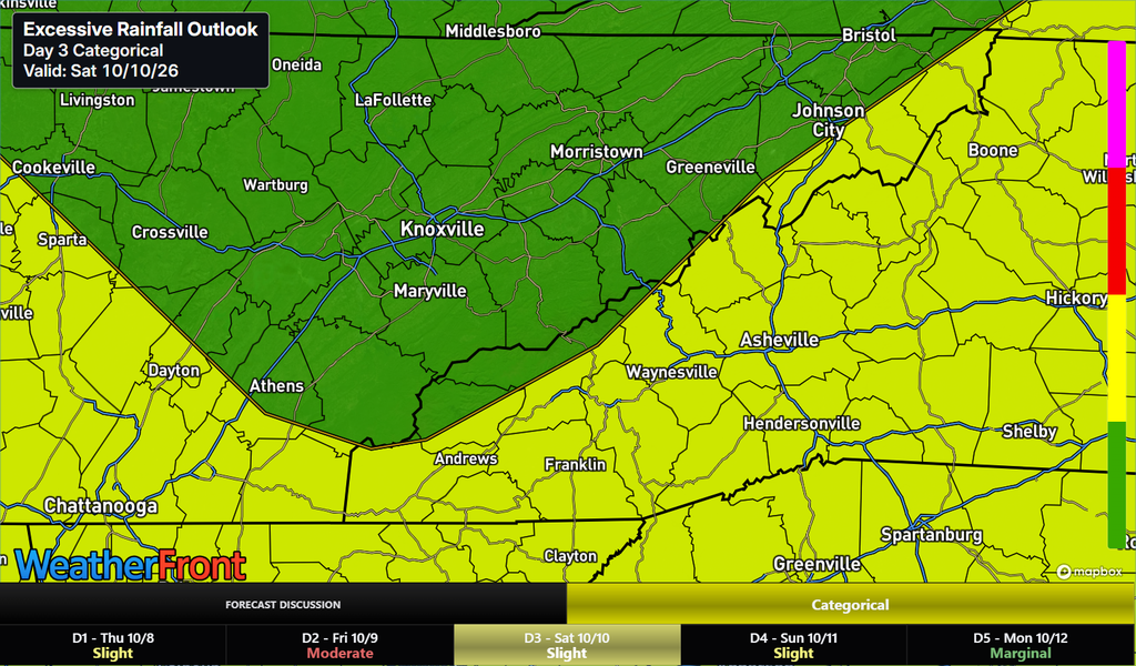
HEAVY RAIN AND FLOODING
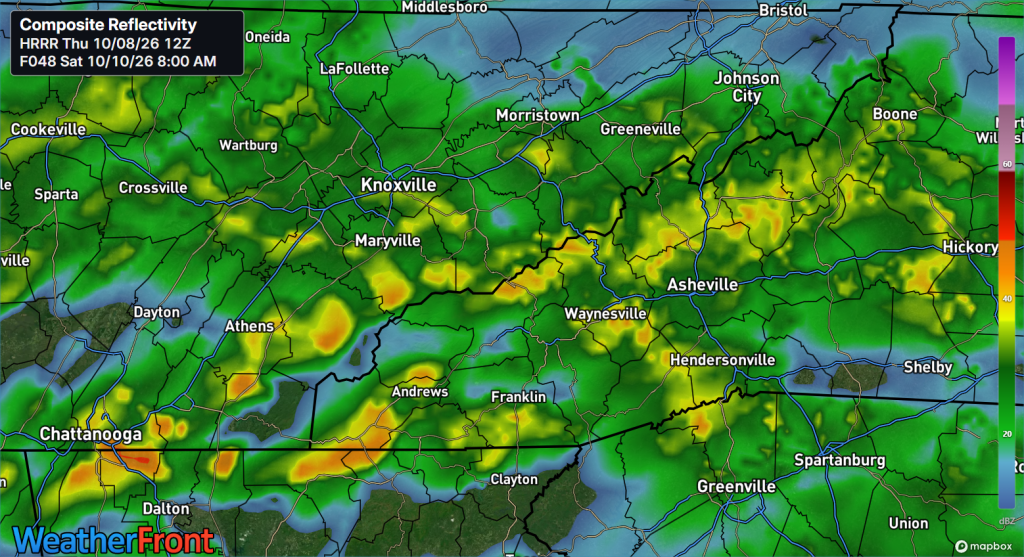
Heavy rain is expected to develop across the southern Tennessee Valley Saturday morning before spreading north through Saturday afternoon. Widespread rainfall is expected across much of the region Saturday into Sunday.
- East Tennessee: Heavy downpours could lead to isolated flash flooding, especially in areas that receive persistent rainfall.
- Western North Carolina: Rainfall amounts have increased across the Blue Ridge Mountains, with excessive rainfall possible Saturday night into Sunday.
- Blue Ridge Escarpment: This area faces particular concern for excessive rainfall and localized flooding.
Even if rainfall totals vary from one community to another, heavy downpours can quickly create hazardous conditions. Never drive through flooded roadways, and be especially cautious near creeks, streams and low-water crossings.
NORTH CAROLINA: ADDITIONAL CONCERNS
North Carolina mountain communities should prepare for a combination of heavy rainfall, gusty winds and a low-end tornado threat in portions of the region.
The strongest rainfall concerns are expected along the Blue Ridge Escarpment Saturday night and Sunday. Gusts of 45-55 mph could bring down limbs and trees, particularly in exposed areas.
Residents and visitors should secure outdoor items, monitor changing weather conditions and have multiple ways to receive weather warnings. Anyone staying in a cabin or traveling on mountain roads should be prepared for possible falling trees, power outages, reduced visibility and localized flooding.
WHAT YOU SHOULD DO
- Secure outdoor furniture, decorations and other loose items before winds increase.
- Avoid parking or sheltering beneath trees during periods of strong winds.
- Charge phones and essential devices in case of power outages.
- Monitor Smokies.LIVE Storm Center updates and official weather alerts throughout the weekend.
- Never walk or drive through floodwater.
- If a tornado warning is issued for your location, move to an interior room on the lowest floor of a sturdy building, away from windows.
BOTTOM LINE: Plan ahead and use caution this weekend. Strong winds will be the primary concern in the higher elevations, while widespread rain and localized flooding could affect communities across East Tennessee and western North Carolina. Conditions may change as Isaias moves inland, so continue monitoring the latest forecasts and warnings.

No responses yet