


Flash Flood Warning issued for parts of Knox and Blount counties as heavy rain moves through. Up to 5 inches of rain possible in some areas as thunderstorms trigger flooding concerns across the Knoxville metro.
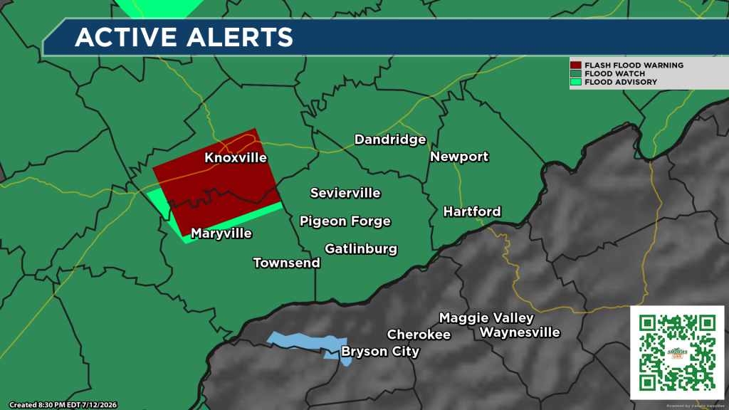
KNOXVILLE, Tenn. — The National Weather Service in Morristown has issued a Flash Flood Warning for portions of southern Knox County and northwestern Blount County as slow-moving thunderstorms continue to produce heavy rainfall Sunday evening.
The warning remains in effect until 11 p.m. EDT.
As of 8:18 p.m., Doppler radar indicated thunderstorms producing heavy rain across the warned area. Forecasters said between 1 and 3 inches of rain had already fallen, with an additional 1 to 2 inches possible through the evening.
Flash flooding is either already occurring or is expected to begin shortly, according to the National Weather Service.
Communities included in the warning include Knoxville, Alcoa, Farragut, Louisville, Rockford, Bearden and Lake Forest.
Forecasters warned that excessive rainfall could cause flooding of small creeks and streams, urban areas, roads, underpasses and other low-lying or poor-drainage locations.
Drivers are urged to use caution, especially along portions of Interstate 40 between mile markers 373 and 393 and Interstate 75 near mile marker 108, which are included in the warned area.
Officials remind motorists to never drive through flooded roadways. Just a small amount of moving water can sweep a vehicle away, and it is often impossible to determine the depth of floodwaters after dark.
Residents in the warned area should monitor weather conditions and be prepared to move to higher ground if flooding develops.
No responses yet