

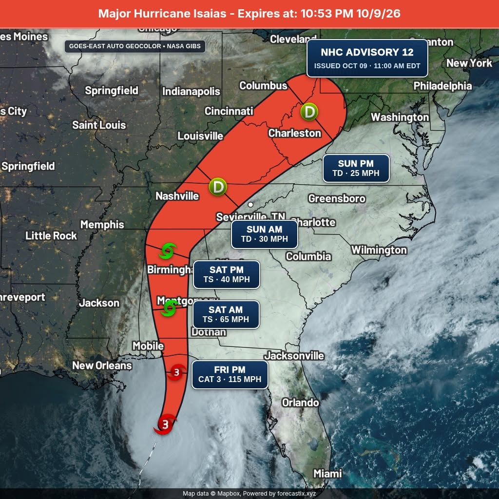
I’m tracking the impacts of Isaias across East Tennessee and the western North Carolina mountains this weekend. Strong winds, heavy rain and localized flooding are the main concerns.

🌬️ STRONG WINDS: Gusts of 30–40+ mph are possible across many areas, with 60–70 mph gusts in higher elevations. Some exposed mountain locations could see even stronger gusts.
🌧️ HEAVY RAIN: Rain spreads across the region Saturday into Sunday, bringing the potential for isolated flash flooding. The Blue Ridge Escarpment in North Carolina is a particular concern for excessive rainfall.
🌪️ ADDITIONAL THREATS: A low-end tornado threat is possible in parts of the region.
🏠 WHAT TO DO NOW:
• Secure outdoor furniture and loose items.
• Charge phones and prepare for possible power outages.
• Know your flood risk and never drive through flooded roads.
• Monitor official weather alerts throughout the weekend.
If you’re visiting the Smokies, traveling mountain roads or staying in a cabin, please use caution and have a plan.
I’ll continue tracking the forecast and sharing updates for Tennessee and western North Carolina through the Smokies.LIVE Storm Center.
Be prepared. Stay informed. Stay safe.
#SmokiesLIVE #StormCenter #HurricaneIsaias #EastTennessee #WesternNorthCarolina #SmokyMountains #MountainWeather #SevereWeather #FloodSafety #WeatherAlert

No responses yet