

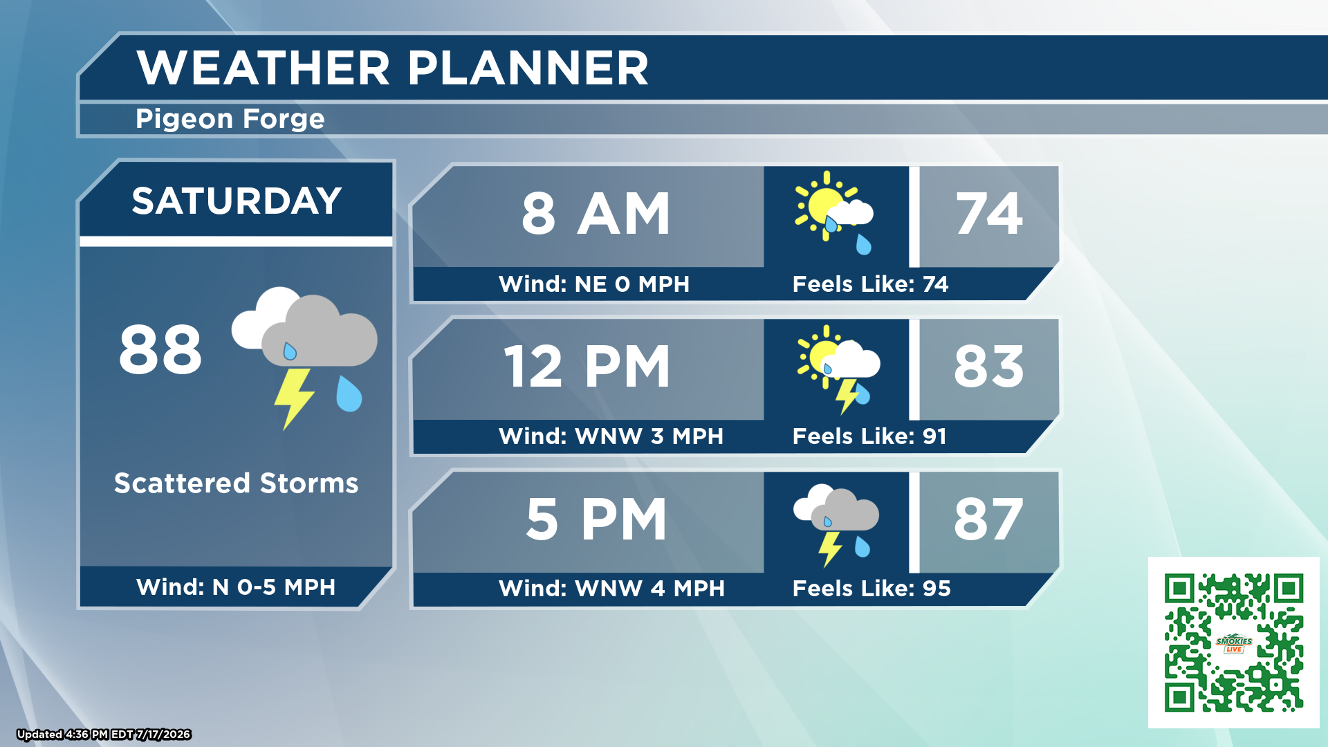
Smokies.LIVE Storm Center Meteorologist Kyle Grainger says the best weather arrives early before afternoon thunderstorms bring the potential for flash flooding, gusty winds and dangerous lightning across the region.
By Smokies.LIVE Storm Center Meteorologist Kyle Grainger
If you’re heading to the Grainger County Tomato Festival, spending the day on the lake, or planning a hike in the Great Smoky Mountains, be prepared for changing weather conditions as storm chances steadily increase throughout Saturday.
The day won’t be a washout, but it will become increasingly unsettled as abundant Gulf moisture combines with weak steering winds in the atmosphere. That setup means any thunderstorm that develops could move very slowly, producing torrential rainfall over the same locations and creating a localized flash flooding threat.
Saturday begins on a quieter note with only a 20% chance of rain during the morning, making the early hours the best opportunity for outdoor plans. By around noon, rain chances increase to 40%, before climbing to 60% during the afternoon and evening as showers and thunderstorms become more numerous.
High temperatures will reach around 85 degrees under a mix of sunshine and developing clouds. Winds will remain light, allowing storms to linger once they form.
A few thunderstorms could become strong to severe, capable of producing gusty winds, frequent lightning and very heavy downpours. With abundant moisture and weak winds throughout the atmosphere, storms may repeatedly move over the same locations, increasing the risk of localized flash flooding. If you encounter a flooded roadway, remember: Turn Around, Don’t Drown.
Those attending the Grainger County Tomato Festival, which runs from 9 a.m. until 6 p.m. Saturday, should take advantage of the drier weather early in the day, but keep an eye on the sky through the afternoon. Have a plan to move indoors quickly if thunder is heard or storms approach.
Boaters across East Tennessee should also stay weather-aware. Thunderstorms can develop rapidly, bringing dangerous lightning, sudden wind gusts and sharply reduced visibility. If skies begin to darken or thunder is heard, head back to shore immediately.
If you’re planning a hike in the Great Smoky Mountains, an early start will offer the best chance for dry trails. Afternoon storms can develop quickly in the higher elevations, creating slick trails, rapidly rising streams and dangerous lightning. Be prepared to cut your hike short if storms begin to build.
Showers and thunderstorms will continue into Saturday night, with temperatures falling to around 71 degrees. Sunday will feature a very similar weather pattern, with additional scattered showers and thunderstorms expected during the afternoon and evening. Any storm this weekend will be capable of producing locally heavy rainfall, so stay weather-aware if you have outdoor plans.
The bottom line: Don’t cancel your weekend—just plan around the weather. The best opportunity for outdoor activities will be during the morning hours before storm coverage becomes more widespread later in the day.
Stay with the Smokies.LIVE Storm Center and Meteorologist Kyle Grainger for the latest forecasts and any watches or warnings issued throughout the weekend.
No responses yet