

(SEVIERVILLE, Tenn.) SMOKIES.LIVE – A strong line of storms will move across Tennessee in the early morning hours of Tuesday. The storms will be strong for plateau areas as they reach the Knoxville valley area.
Storms will stay strong through 8 a.m. moving into the Smoky Mountain Region. The primary threat for the Tennessee side of the Smokies will be gusty winds and small to medium size hail.
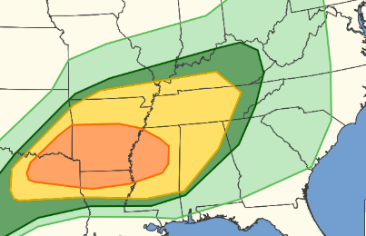
The Storm Prediction Center has a large area of the South under a threat for tornadoes. That includes about 7 million people from Texas to Mississippi. A tornado threat for the Smoky Mountains is very minimal. Strong winds though can bring down trees, tree limbs and power lines.
You should listen for the latest alerts with your phone turned on early on Tuesday morning. A second threat for storms will develop later in the day.
Winds will gust to 20 mph plus going into the early morning hours.
For the North Carolina side of the Smoky Mountains. Storms will weaken as they move into Swain and Haywood Counties. There’s a small window between 4 a.m. and 8 a.m. we need to watch for enough winds and small hail to cause some power problems. I would park my car under a shelter if you can.
Rain continues through the day giving about a tenth of an inch of rain. Much more is needed, but this will give some moisture to a very dry area.
The lightning threat will be serious as this could spark a random brush fire. Report all smoke sightings to 9-1-1 immediately for a full investigation.
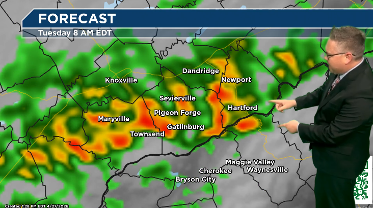
A severe storm threat reemerges near the midnight timeframe with the smaller, but still impactful wind and hail threat.
No responses yet